"Drawing the world, a history of cartography" invites visitors to step back in time and understand how our perception of the world has evolved.
understand how our perception of the world has evolved, through the presentation of a number of maps and objects.
Maps that were drawn to show roads, but not only roads.
Maps describing stars, winds and currents can be found all over the world.
The exhibition invites visitors to discover the oldest known map of Europe. It dates from the Bronze Age, around 2000 BC. It was discovered in Leuhan (Finistère) in 1900. Today, the scientific community agrees that it represents the course of the Odet and the Montagnes Noires.
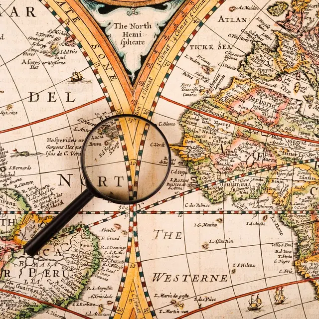
Over time and with scientific progress, maps have developed. From simple coastlines, they have been enriched with information about the fauna, flora, populations and their way of life.
Illustrated by artists such as painters and illuminators, maps became art objects in their own right, while becoming more accurate and reliable.
Nautical charts, showing coastlines, depths and the presence of obstacles, are of course featured in this exhibition. Their accuracy is crucial to navigation and the safety of people, ships and their cargo.
The exhibition also takes a step back in time, with a look at the production of modern maps and the ingenuity of satellite maps.
Today, the world as a whole can be seen in minute detail from a smartphone.
To put together this exhibition, the Musée de Sainte-Marine collaborated with the Port-Musée de Douarnenez, the Musée de la Pêche de Concarneau and SHOM, the national hydrographic and oceanographic service based in Brest.
understand how our perception of the world has evolved, through the presentation of a number of maps and objects.
Maps that were drawn to show roads, but not only roads.
Maps describing stars, winds and currents can be found all over the world.
The exhibition invites visitors to discover the oldest known map of Europe. It dates from the Bronze Age, around 2000 BC. It was discovered in Leuhan (Finistère) in 1900. Today, the scientific community agrees that it represents the course of the Odet and the Montagnes Noires.
Over time and with scientific progress, maps have developed. From simple coastlines, they have been enriched with information about the fauna, flora, populations and their way of life.
Illustrated by artists such as painters and illuminators, maps became art objects in their own right, while becoming more accurate and reliable.
Nautical charts, showing coastlines, depths and the presence of obstacles, are of course featured in this exhibition. Their accuracy is crucial to navigation and the safety of people, ships and their cargo.
The exhibition also takes a step back in time, with a look at the production of modern maps and the ingenuity of satellite maps.
Today, the world as a whole can be seen in minute detail from a smartphone.
To put together this exhibition, the Musée de Sainte-Marine collaborated with the Port-Musée de Douarnenez, the Musée de la Pêche de Concarneau and SHOM, the national hydrographic and oceanographic service based in Brest.